
Hurricane Irma continues to grow, could pose threat to the East Coast
Courtesy of the Tribune News Service
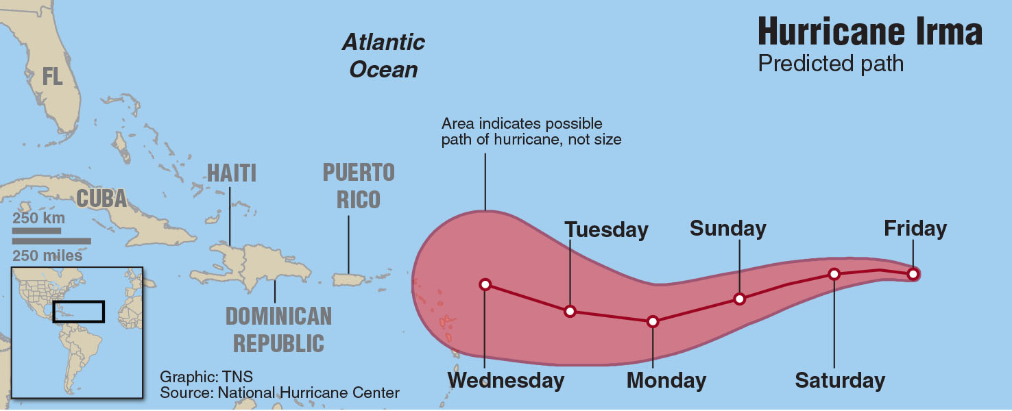
The predicted path of Hurricane Irma shows it hitting the Atlantic Islands of Puerto Rico, the Dominican Republic, Haiti and Cuba as well as south Florida.
Hurricane Irma has grown into a Category Five hurricane and is projected to continue its growth as it makes its way through the Atlantic, possibly colliding with either the East Coast or southern Florida, the Leeward Islands and Puerto Rico.
The hurricane hit the small Carribbean Islands on its way to Puerto Rico and has grown into a Category Five hurricane, according to CNN. According to a report from The Weather Channel, “It remains far too soon to speculate on eventual potential U.S. impact, but East Coast residents should monitor closely.”
In regards to how this storm could impact UNC Wilmington, the Environmental Health and Safety department [EH&S] is monitoring the storm closely and preparing to make decisions on how to act if the storm does approach campus.
“EH&S is closely watching Irma and we have been for quite some time,” said Stan Harts, director of EH&S. “We work with the National Weather Service as well as local and state emergency management agencies in analyzing the forecast.”
An email sent out by the Office of University Relations said that UNCW officials would be monitoring the track of Hurricane Irma and the development of other tropical systems in the Atlantic Ocean.
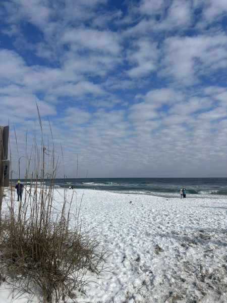
“While direct impacts on the Wilmington area appear unlikely at this time, they are not impossible, given the storm’s size and intensity,” the OUR email read. “There remains an increased risk of rip currents along the beaches near UNCW’s main campus. Please visit the National Weather Service rip current risk site before heading to the beach.”
While some forecast models have the storm passing close to UNCW, the range of errors is very high outside a five day forecast window. EH&S likely will not have an accurate picture of the path until Wednesday at the earliest, Harts said.
“UNCW has a robust and well exercised plan of what to do during hurricanes and a full time Emergency Manager on staff,” Harts said. “If the forecast center of any hurricane is within 50 miles of UNCW, an evacuation is typically ordered that will allow students at least 6 hours of daylight driving time before the onset of hazardous conditions. I think our current message is best summarized by quoting the National Hurricane in its latest advisory discussion.”
The quote in which Harts was referring to is the following: “It is too early to determine what direct impacts Irma might have on the continental United States. Regardless, everyone in hurricane-prone areas should ensure that they have their hurricane plan in place, as we are now near the peak of the season.”
While there is only a slight chance that Irma will directly affect UNCW, according to Harts, EH&S recommends that students know where they would go in the event of a campus evacuation. This can mean returning home or riding home with friends who live closer. Students should not plan to take shelter at structures on barrier islands or in low lying areas if they remain in the local area. During an evacuation, students should take three to five days supply of toiletries, medications, clothing and any items that are irreplaceable.
OUR had similar sentiments, stating in their mass email, “At this point, a campus evacuation is unlikely, but not impossible. In the event that an evacuation is required, students will be notified with no fewer than 6 hours of daylight driving time. More information about the university’s evacuation policies is available here. Now is also a good time to review campus emergency procedures and your personal preparation plan.”
While there is no further information available at this time, the university said that they will share updates on the university website as well as their social media platforms as information is available.
“Please continue to monitor your inboxes and the UNCW homepage and social media feeds (Facebook and Twitter),” the OUR email read. “In the event of closings or cancellations, we will also activate the Emergency Information Hotline at 1.888.657.5751.”
Additionally, Harts suggests that students know at least two “geographically separate” routes to return to campus after the storm, have a paper map as cellular towers may be down, have a full tank of gas when they return and return during daylight hours.
“We will continue to monitor Irma and other storms as they develop and ask that students remain vigilant through Hurricane season [until Dec. 1],” Harts said.
Last year, the university evacuated campus because of Hurricane Matthew, which was a Category Five hurricane [the first Category Five hurricane in the Atlantic since Hurricane Felix in 2007]. This story will be updated as more information follows.