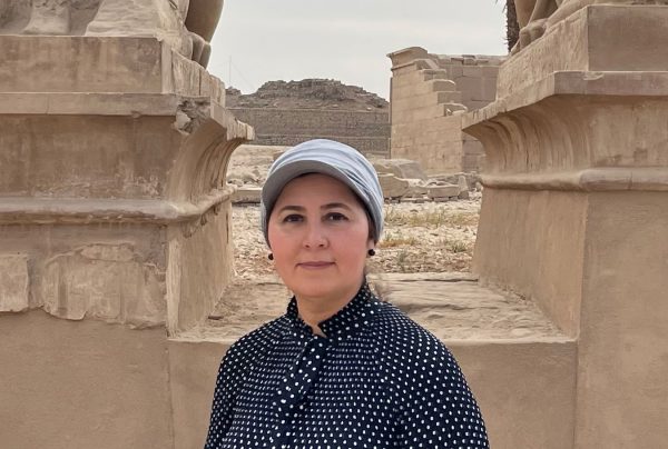
Dr. Eman Ghoneim, a professor in the Department of Earth and Ocean Sciences at UNCW, will lead a research expedition to Egypt in Dec. 2023 in hopes of uncovering lost branches of the Nile and making a complete map of the river.
Ghoneim is the Principal Investigator on this expedition with Co-Principal Investigators from the University of Memphis, University of Chicago, and Macquarie University, Australia. This project has received grants from the National Science Foundation as well as the Explorer Club and Warner Brothers Discovery. The information this research yields will have continuous impacts on multiple scientific disciplines, to Egypt and the perpetual effects that will ripple from the discoveries made will be everlasting.
“I am Egyptian. The significance is huge, personally, because I was born and raised there,” Ghoneim says. “All the time, we would drive to the western desert where you have all these magnificent ancient monuments, temples, cemeteries. I was fascinated with these ancient civilizations.”
Ghoneim received her bachelor’s degree in Geography and master’s in Geomorphology at Tanta University, Egypt. She completed her Ph.D. in Physical Geography, Faculty of Science at Southampton University in the UK in 2002, where she wrote her dissertation on characterizing the flash flood potential in the arid Red Sea region of Egypt.
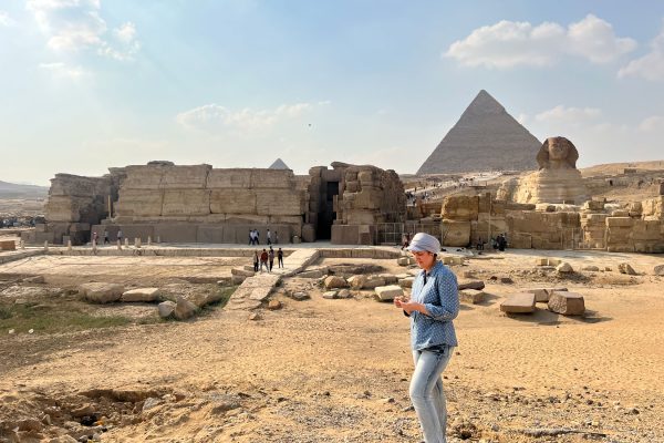
This project aims to utilize Geospatial Information Systems (GIS) to survey the designated area from space. Remote sensing is a powerful tool and is uniquely fit for a project such as this. According to Ghoneim, remote sensing is currently the ideal method to best grant us access to the ancient, buried branches of the Nile and the world of information that lies beneath the land.
“This work could not be done without using geospatial technology,” Ghoneim says. She discusses how this technology provides information that you do not see when walking in the field. This map will go on to benefit archeologists, paleohydrologists, geophysicists, anthropologists and many more, but it is being made from scratch. “The first step is remote sensing. And I am remote sensing.”
Ghoneim believes in looking at the big picture. “That’s why we start with seeing everything from above,” she says. “From space.”
Radar satellite imagery will be extremely useful, as Ghoneim explains that radar is like an x-ray. “It can penetrate the land and reveal this hidden world,” says Ghoneim.
If there is an anomaly spotted in the satellite processed images, the team will go to that specific site to conduct geophysical surveys and soil samples to determine if the anomaly was indeed a potential former branch of the Nile. Ghoneim hopes to be able to map as much as she can about the branches in terms of their width, depth and where the embankment was. This will help determine where people built their houses, as well as dating the samples and ensuring that the channel in question was in fact active during the time of ancient Egyptian civilization.
“The Nile is a gift to Egypt, in the middle of the desert. The Great Sahara,” Ghoneim says. “It is the only place that has running water. No civilization in the world was established without fresh water.” Ghoneim refers to the Nile as a sort of “super-highway” that allowed for a vast transportation of material, goods and manpower that could efficiently travel within the Nile and its former branches.
“You always find rivers [with] civilization,” says Ghoneim.
The Nile has been reduced to two main branches, the Rosetta and Damietta. They are manually maintained and manipulated which greatly alters the natural flow patterns. The river has also naturally shifted over time. Archeologists and many other fields of scientists who use the Nile as a tool to presume where ancient archeological sites were located would greatly benefit from a completed map of the river. It would supply data on where the river flowed and the neighboring civilizations that likely would have built alongside it, thereby helping to preserve more sites before they can be built upon and damaged.
Despite working near and around historical landmarks, Ghoneim does not anticipate any opposition to her project. Projects like these are encouraged by the government. “When you study such a unique historical site, it is truly important because you are studying world heritage, not just the Egyptian heritage,” Ghoneim says.
This project could help uncover additional archeological sites that will be logged and protected, which then helps protect the land from further urbanization. Urbanization is an increasing issue that is directly affecting the Nile area and local agricultural land, of which there is only 6-7% in all of Egypt.
One of the locations that will be surveyed throughout this project is the Meidum Pyramid suspected to have been built by Pharoah Snefru in the fourth dynasty of the Old Kingdom. Known to the locals as “The Lying Pyramid,” or “The False Pyramid,” it appears to be a cross between a step pyramid and a smooth-sided pyramid. Due to its collapsed condition, it is believed to have been abandoned before completion.
“We think there was an instability in the area the Egyptians found that made it impossible to continue. The location was probably surrounded by channels,” Ghoneim says. “We are taking all of the debates and trying to understand that. And we are relating all of this to the ancient channels.”
Local outreach will also be an important part of this expedition. To ensure the engagement of the public in science, PI Ghoneim is committed to delivering a talk to the Egyptian youth to inspire them and show the importance of archaeology and cultural heritage as well as expose them to a variety of STEM topics and opportunities.
“We want to teach kids to respect the land, the archeologist who come to explore the land, to give them this vision to the future,” Ghoneim says. “I am Egyptian. I studied to be able to do this and to be able to give back to Egypt.”
Ghoneim hopes to inspire the local youth, especially young girls, to understand this motivation to pursue what you are passionate in and all that can come from it.
“Do what you love, not what the market needs. You will do wonders if you pick up what you love.”










George Jarry • May 17, 2024 at 7:57 pm
Dear Eman
Giza pyramid weight 6.500.000 tonnes, how many time spend to transport over a vessel by the old Nile river branch, and then how this stones from 2 to 60 tonnes was elevated.
31 pyramids take a lot of time, just to transport the stones.
Best regards
George Jarry
Cheryl Forester • May 17, 2024 at 12:40 am
Thank you for your devotion to uncovering the origin and changes in the Nile. This land is definitely the original seat of all our populations and heritages. If i was only younger I would join your quest for answers. I am 80 years old and studied Egyptian Arts and Sciences in Detroit at the original College of Creative Studies in conjunction with The Detroit Institute of Arts. Professor Snowdon taught me so much about Egypt as he studied and worked there. Thank you from my heart!